

New innovations in technology for AEC are poised to significantly improve processes.
Civil engineering, construction and land surveying may not seem like the most innovative or rapidly changing industries, but every day there are new technologies that can significantly increase productivity within an organization, from saving employees time and effort, to completely revolutionizing business processes. One such innovation is the implementation of drones or UAVs into aerial surveying, which has allowed surveyors to gather large amounts of high-quality project data in a short amount of time, allowing projects to be more accurate and completed faster than ever before.
This new gathering of high-quality data results in challenges that firms in the construction industry have never had to face before, such as dealing with increased processing cost and effort, needing to hire subject matter experts and, making significant investments in tools and software to make handling these challenges swiftly. These challenges end up overwhelming AEC firms, especially since this new drone-collected aerial data requires both photogrammetric processing as well as subsequent drafting in CAD. Even more true is the fact that, for small and medium businesses, moving towards being technologically savvy can quickly become an unbearable financial burden.
As a company, we recognized these challenges and decided to come up with an innovative way to help businesses harness their aerial datasets. Our product uses artificial intelligence (AI) and machine learning algorithms to train a predictive software that first recognizes topography, vegetation, buildings and roads in aerial images and then autonomously converts them into fully rendered CAD files.
By using our software, companies can significantly reduce the time it takes to go from data collection to CAD drafting by weeks when compared to traditional methods, and it allows employees to focus on more critical tasks rather than continuing to do manual drafting work.
See a preview of our product in action below:
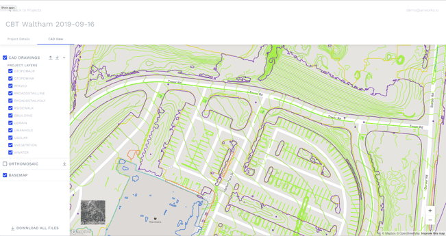 The
The
AirWorks web application lets companies select which layer they want to see in their final CAD output.
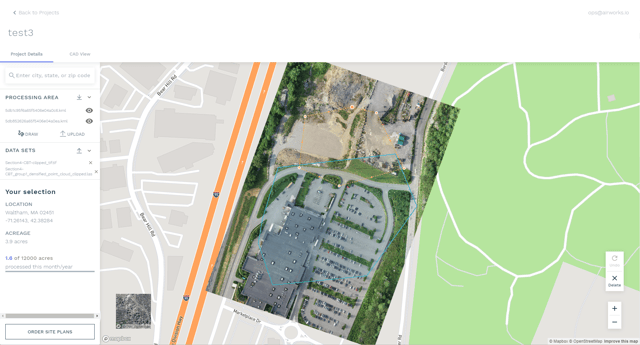
View your .tif and draw .kml directly in the app, as well as order site plans!
To learn more, visit our website at https://airworks.io/.