

Used to mark the boundaries and various features and structures of a land plot, land surveying is one of the first and most critical steps in a construction project. From planning housing developments and commercial properties to building roads and railways, land surveying has a wide variety of applications. They’re most often used by:
-
Land developers
-
Architects
-
Civil engineers
-
Building contractors
-
Construction Project Managers
-
Real estate agents
-
Homebuyers
Traditional Land Surveying Equipment
Land surveying has historically been a tedious and expensive endeavor. Manual processes conducted with low-tech handheld instruments have been the norm for nearly 6,000 years.
Surveyors have traditionally relied on equipment like:
-
Transit levels
-
Sextants
-
Theodolites
-
Plumbobs
-
Ranging rods
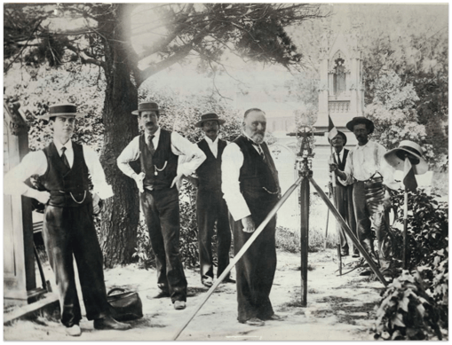
Although these tools have been used for generations, due to the manual nature of the work they can result in an accumulation of inaccuracies in a survey. Furthermore, they result in a labor-intensive and time-consuming process, particularly for major development projects on large plots of land. Traditional surveying methods often don’t suit the needs for engineers under pressure to start the design process – and designing without an accurate survey can frequently result in project delays and can be an obstacle to the acquisition of a site or an acquisition that is made with the added risk of insufficient data.
A More Efficient Way
Like many other industries and professions, advancement in surveying technology has accelerated since the turn of the millennium. The introduction of GPS, GIS, and Lidar have reduced the time it takes to create accurate existing conditions drawings, but the introduction of unmanned aerial vehicles (UAV), drone imaging and AI-powered software are prone to completely revolutionize the industry. The generation of maps and site plans, 3D building information models (BIM), and construction project quality control will all been transformed through the combination of these technologies.
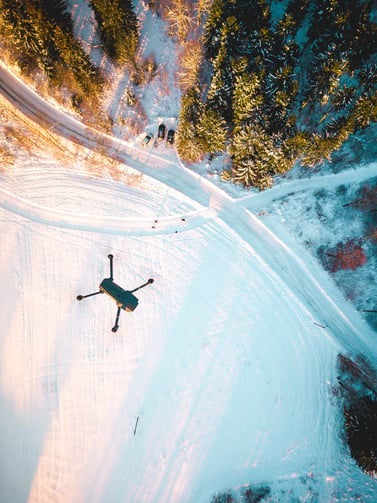
A process that traditionally took months to complete, often delaying the progress of a development projects, has already been reduced to 1-2 weeks through highly accurate aerial imagery obtained by a UAV. Together with automated processing the time to get initial site drawings will be further and further reduced.
The Benefits of Using UAV for Land Surveying
Faster and More Cost Effective
Faster turnaround times allow developers, contractors, and engineers to start design earlier and to view updated site progress throughout the construction project. It will also help to flag any errors early, reducing expensive rework costs later.Having this data available earlier allows engineers to start designing based on actual existing conditions, reducing the risk of design errors and the overall engineering time.Rework can often reach 10% of the total cost of a large-scale construction project. The technology is equally as useful in the property acquisition and initial development planning phases, making it an invaluable risk management tool.
Improved Safety
UAVs have the capability of scanning the roughest, remotest, and even unreachable areas, mitigating the inherent human safety risk that these places pose. Furthermore, the obvious risk of having a surveyor working roadside on a fast-moving highway is eliminated. Human safety and the financial cost of an accident claim are always top of mind during construction and civil engineering projects.
Proprietary Software
Through proprietary machine learning and aerial mapping technology, we can convert any aerial dataset into site plans in CAD fully autonomously, speeding up the current process by weeks. AirWorks’ is also developing a platform that will allow clients to upload their aerial data and turn it into topographic maps and line drawings fully autonomously. Our vision is that accurate existing conditions can be produced easily on any site – helping engineers and surveyors to focus on complicated work that requires humans in the loop, such as interpreting drawings and design work. Be the first to know when this platform is available by subscribing here.
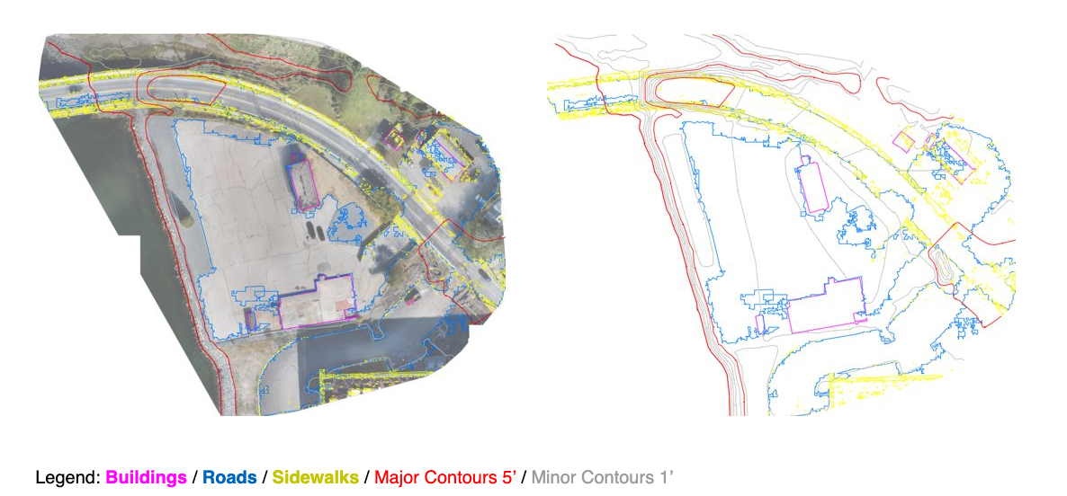
Image tracing outputs from our proprietary software.
Want to learn more about leveraging UAV and AI technology for your next construction site survey? Visit our website at https://airworks.io/.