

America’s capstone civil engineering convention, the ASCE Convention 2019 took place in Miami from October 10-13. this year‘s conference was all under the theme of the Future World Vision with a deep-dive in the Floating City.
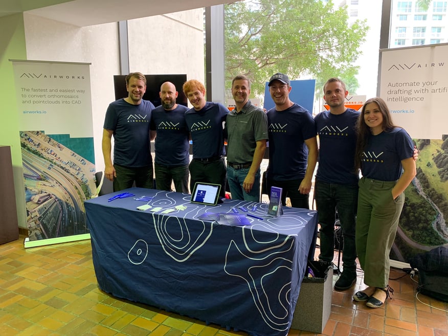
Together with the multimedia creative company Experimental (creators of the movie Minority Report), the ASCE team has analyzed drivers and trends in our current societies that will impact the way we live in the next 10, 20, 30, 40 and 50 years to understand the impact on the civil engineering profession. Civil engineers are at the forefront of this change, as with their work, they design and define the urban and suburban architectures of the future. AirWorks was a platinum sponsor of the ASCE convention - as this theme fit extremely well with AirWorks‘ mission to make aerial data accessible and useful for decision makers in the built environment. At the conference, AirWorks presented the early release version of our aerial data processing software, an AI-based aerial data platform that allows engineers autonomously analyze and classify aerial surveys and maps in CAD and save hundreds of hours of drafting time. Relive here the launch of the AirWorks software being unveiled.
ASCE Future World Vision
The Future World Vision projects was created to give engineers a glimpse of key trends and a range of plausible future based scenarios to imagine possible living spaces of the future. It’s a data-driven approach based on scenario-planning analysis which recognizes that many factors combine in complex was to create sometimes surprising futures. The purpose of the exercise is to give engineers the tools to lead the design, built, operation and maintenance of the cities and infrastructures of the future and the way there. It’s supposed to help engineers optimize desirable outcomes while avoiding undesirable and unintended consequences. It’s also supposed to prepare civil engineers for the challenges of tomorrow.
This video presents a small teaser of the future world vision: VIDEO
To do that, ASCE has examined future macrotrends that they ultimately used to build possible city models envisioning the way societies operate in the future. These trends are the drivers for change and the major ones are Alternative Energy, Autonomous Vehicles, Climate change, Smart cities, High tech construction and advanced materials and Policy & funding.
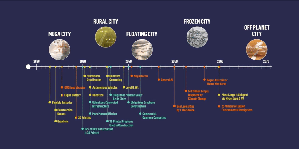
Image from asceconvention.org
Based on the trends, the Future World Vision team has presented the concepts of five future worlds, which can be experienced in 4D and combine the findings of the research to scenarios that are easy to imagine and inspire decision making. The future worlds are the Mega City, which is already somewhat happening today, the Rural City, the Floating City, the Frozen City and the Off-Planet City.
This year's ASCE convention, featured the creation of the Floating City, a resilient city that sustains the impact of climate change leading to droughts, storms and sea level increases as well as increasing stresses on urban services to population growth. All this is featured in the Floating City model for the future that could be discovered at ASCE through virtual reality technology.
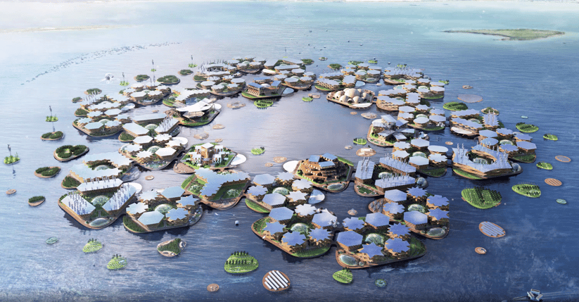
Image from Oceanix.org
Conference Highlights/Shows
Besides the Future World Vision, the conference featured amazing presentations that highlight the advancement of the civil engineering profession and make us excited for what is still to come.
The AirWorks team selected the following as highlights of our time at the convention. We learned about how AI is optimizing water systems to predict failures in water pipes before they occur. We attended an amazing presentation on the feat of engineering and surveying in designing and building the transcontinental rail road. Using 100ft chains and differential leveling, the entire 1868 miles of track was closed within 3 inches! Wow. We would like to thank Karl Feldman of Hinge for his excellent lecture and insights on recruitment and employer branding. The AirWorks team was also blown away by the spectacular careers of the distinguished engineers and would like to thank them for their incredible contributions to the Civil Engineering profession.
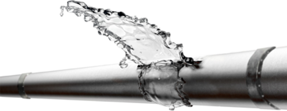
Photo courtesy of voda.ai
AirWorks Software
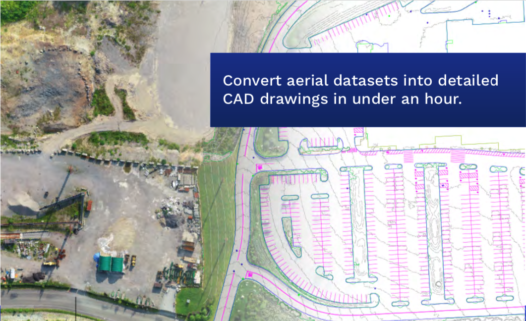
AirWorks software allows engineers to autonomously analyze aerial datasets from UAVs/ drones and converts those datasets into labelled civil engineering drawings. Drones are used more and more to supplement land surveying projects, the data generated by the UAV however requires powerful computers for processing, and feature extraction has been manual, time consuming and cumbersome. In fact, we have seen that often surveying professional would rather stick to traditional surveying tools than dealing with the burdens of analyzing aerial data manually. AirWorks software solves that problem. Our web application provides engineers with a processing light solution to open and analyze aerial datasets, and our algorithms handle the majority of the labeling and feature extraction tasks automated and in a fraction of time. Engineers and surveyors can upload standardized orthomosaics (.tiff) and pointclouds (.las) and download drawings in .dxf formats. In the near future we’ll offer downloads also as .shp and .geojson files.
This technology is essential to enable the trends and scenarios that are address in The Future World Vision project. It will be instrumental as we design development projects faster and in changing environments, such as water fronts, floating cities or resilient cities. It’ll also be instrumental for autonomous construction, as we’re planning to have machines, that rely on accurate data operate on construction sites autonomously.
Today, automated aerial data analytics has the potential to reduce the design and permitting process by up to two months, and allow better purchasing decisions due to more readily available data. In the future, it can help speed up construction and detect climate threats and changing environments early on to reduce risk and increase agility for societies. First companies are currently launching their drone delivery services, and as we see this trend continue, aerial data is going to be omnipresent. Together with the AirWorks software, that means that we can survey cities and large pieces of lands autonomously to keep track of changes, produce drawings of engineering projects or 3D building models autonomously without ever setting foot on the site. AirWorks is excited to be at the forefront of that future, and we look forward to developing it with you.